Breadcrumb

  1. Home
  2. Search Maps
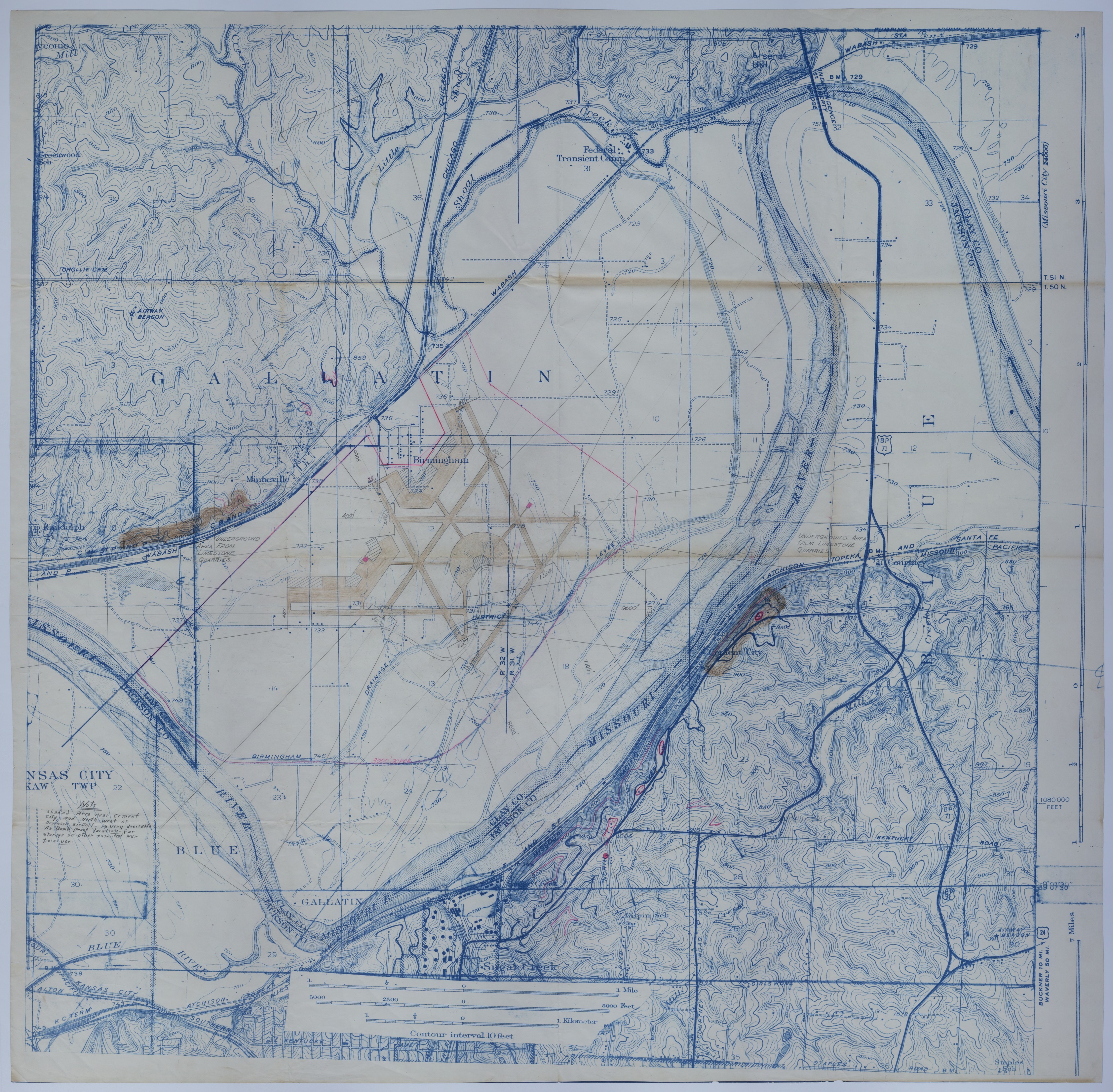
  3. Map of a Proposed Airport near Birmingham, Missouri

Map of a Proposed Airport near Birmingham, Missouri

Map of a Proposed Airport near Birmingham, Missouri
Accession Number
M126
Keywords
Photo Color
Color
Physical Size
40 X 41 3/4 inches
Restrictions
Undetermined
Scale
6 inches = 1 mile
TIF Identifier
M126.tif
Rights

The Library is unaware of any copyright claims to this item; use at your own risk.

Note: If you use this image, rights assessment and attribution are your responsibility.

Credit:

Courtesy Harry S. Truman Library & Museum, Independence, Missouri.

Attention media: Please make note of this item's map number. Print out this page and retain it for your permissions records before downloading this image file for possible publication. Library staff cannot sign permissions forms or provide additional paperwork. The Library charges no usage fees for downloaded images. Fees are charged for higher resolution scans.

Description

A relief map of Jackson and Clay County, Missouri. Included are annotations and drawings relating to a proposed airport near Birmingham, Missouri. The pink lines signify the proposed boundary of the airport and other potential areas of use. An annotation near the bottom left corner of the map reads: "Note: Shaded area near Cement City and north-west of proposed airport-is very desirable as bomb proof location-for storage or other essential war time use." Handwriting on the back reads: "Jackson County, MO" and "3300."

Date(s)

Content last reviewed: May 31, 2019