Breadcrumb

  1. Home
  2. Search Maps
  3. Map of the Julian March

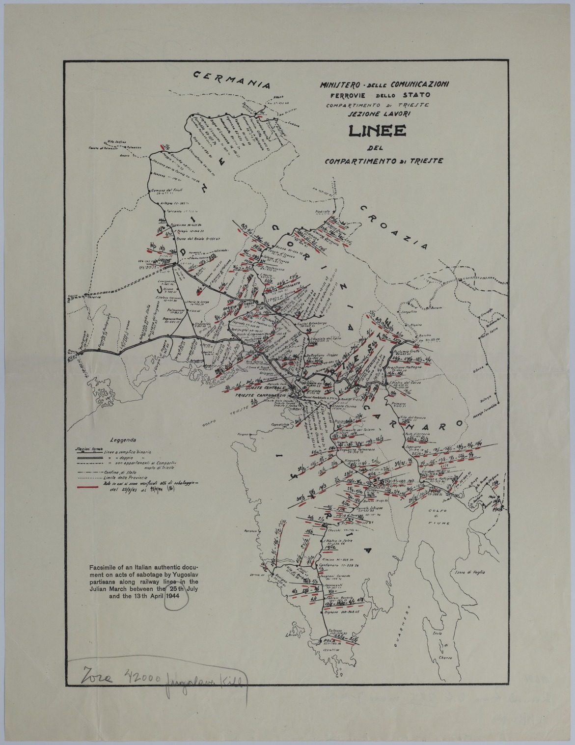
Map of the Julian March

Map of the Julian March
Accession Number
M681
Cartographer
Ministero delle Comunicazioni. Ferrovie dello Stato. Compartimento di Trieste. Sezione Lavori.
Photo Color
Color
Physical Size
18 1/2 X 14 1/4 inches
Restrictions
Undetermined
TIF Identifier
M681.tif
Rights

The Library is unaware of any copyright claims to this item; use at your own risk.

Note: If you use this image, rights assessment and attribution are your responsibility.

Credit: Ministero delle Comunicazioni. Ferrovie dello Stato. Compartimento di Trieste. Sezione Lavori.

Courtesy Harry S. Truman Library & Museum, Independence, Missouri.

Attention media: Please make note of this item's map number. Print out this page and retain it for your permissions records before downloading this image file for possible publication. Library staff cannot sign permissions forms or provide additional paperwork. The Library charges no usage fees for downloaded images. Fees are charged for higher resolution scans.

Description

An Italian map titled "Linee del Compartimento di Trieste." A printed annotation in English reads: "Facsimile of an Italian authentic document on acts of sabotage by Yugoslav partisans along railway lines in the Julian March between the 25th July and the 13th April 1944." The red lines on the map, accompanied by dates, represent the points of the Yugoslav Partisans' sabotage efforts. The other lines on the map represent railways, railway stations, railway stops, and various boundaries. Handwriting is partially illegible but the rest reads: "...42000 Jugoslavo Kill." Handwriting on the back identifies this map as being part of the Official File. The handwriting reads in part: "Removed from O.F. 233, Memo 7-19-46."

Date(s)