Breadcrumb

  1. Home
  2. Search Maps
  3. Map of Soviet Occupation in Iran

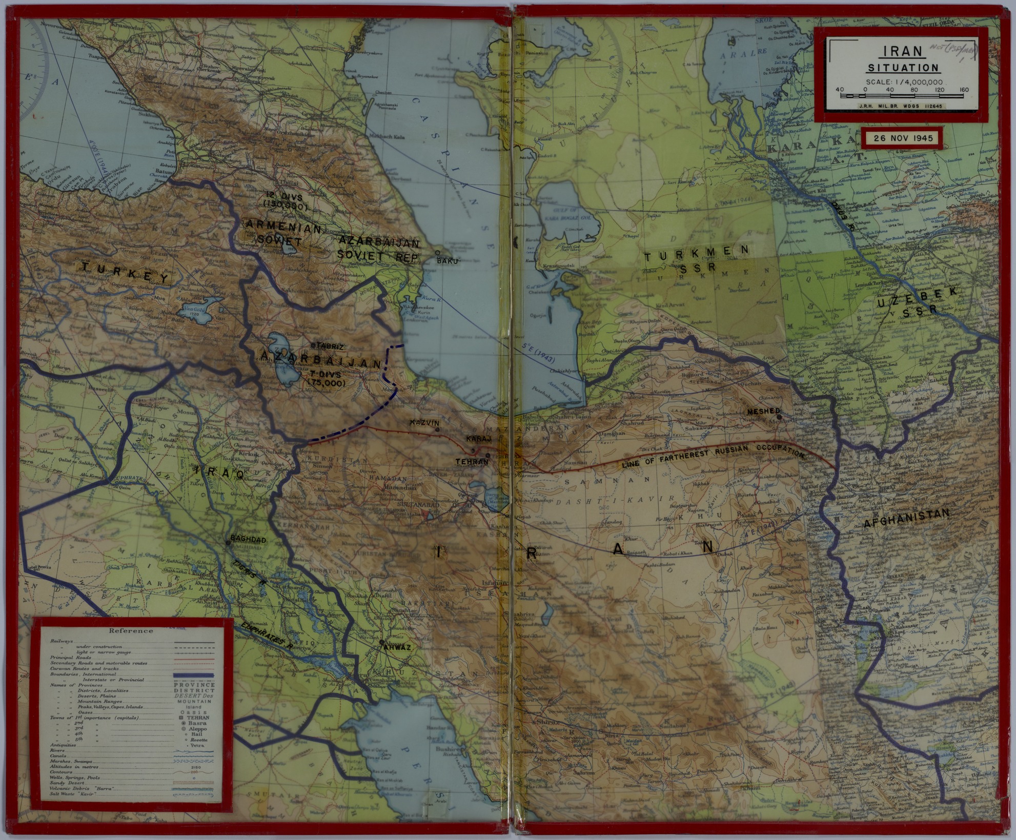
Map of Soviet Occupation in Iran

Map of Soviet Occupation in Iran
Accession Number
M94
Cartographer
War Department, J.R.H., MIL. BR., War Department General Staff, 112645.
Keywords
Photo Color
Color
Physical Size
20 X 24 1/4 inches
Restrictions
Unrestricted
Scale
1:4,000,000
TIF Identifier
M94.tif
Rights

This item is in the public domain and can be used freely without further permission.

Note: If you use this image, rights assessment and attribution are your responsibility.

Credit: War Department, J.R.H., MIL. BR., War Department General Staff, 112645.

Courtesy Harry S. Truman Library & Museum, Independence, Missouri.

Attention media: Please make note of this item's map number. Print out this page and retain it for your permissions records before downloading this image file for possible publication. Library staff cannot sign permissions forms or provide additional paperwork. The Library charges no usage fees for downloaded images. Fees are charged for higher resolution scans.

Description

A map of the post-war situation in northwestern Iran. A plastic overlay, taped on top of the map, has annotations regarding areas occupied by the Soviet Union military, including the number of divisions and troops in a designated area. The dashed purple line highlights the contested region of Iranian Azerbaijan and the red line shows the line of farthest Soviet occupation. The map, under the plastic overlay, shows railways, roads, caravan routes, boundaries, provinces, districts, deserts, mountains, islands, oases, antiquities, rivers, canals, marshes, altitudes, contours, and other details. Correspondence previously attached to this map has been placed in President's Secretary's Files, Subject File, Foreign Affairs File, Iran, Maps.

Date(s)